
|
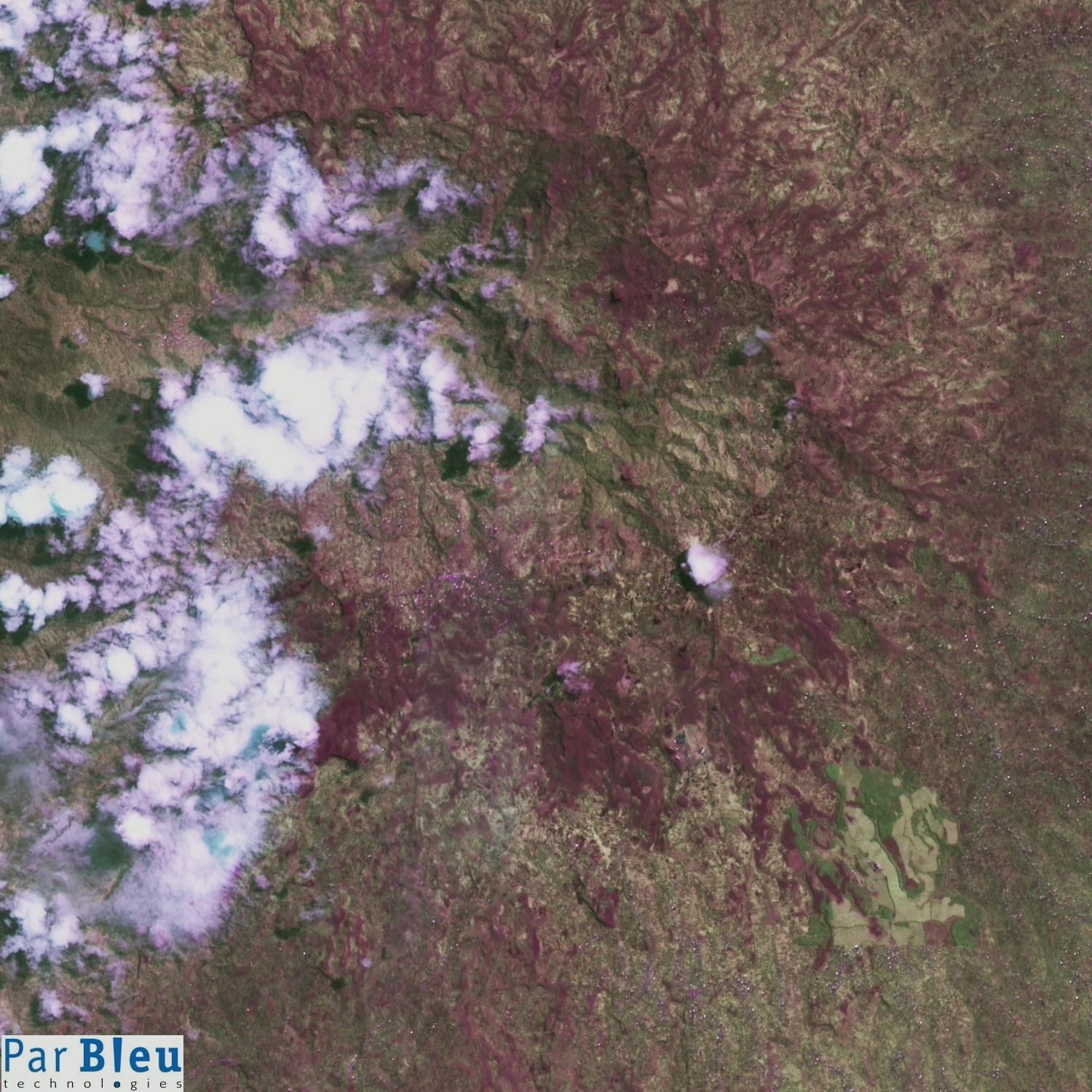
The LANDSAT-7 ETM+ image shown below has been acquired on May 15, 2002 (Courtesy of the University of Maryland, Global Land Cover Facility).
This image has been processed to improve its spatial resolution from the original 30 x 30 meters to 15 x 15 meters, and is shown here at full spatial resolution. This image has been orthorectified and radiometrically corrected using the Digital Elevation Model built using the RADARSAT-1 and ERS-1 SAR (radar) images.
The subset of this processed LANDSAT-7 ETM+ image that is shown below covers a 22.5 x 22.5 kilometers wide area. It shows the great caldera of the Monts Bamboutos, the remnant of a 17 million years old volcano, now collapsed.
This area is the one that suffered the heaviest damages in the whole region since June 2003.
It is a very fertile area, which has attracted many farmers in the last years. Agriculture is practiced there, even on slopes exceeding 30°.
Nevertheless, the increase in population means that forest, a useful natural resource in such a high altitude environment, has been intensively exploited, and also depleted to free the land for agriculture.
Therefore, erosion began to fragilize these volcanic soils, formed of unstable layers of loose material (old volcanic ashes).
Practical examples of identification of potential landslides are illustrated for other places in the region (Bamenka and Djuttitsa).
Compare also with the preliminary damage assessment report.
Produced by PARBLEU TECHNOLOGIES Inc.
Operational partners of PARBLEU TECHNOLOGIES Inc. :
 |
 |
 |
| Privateers NV | Treemail | AP Formation |
Copyright (C) PARBLEU Technologies Inc., 2004