
|
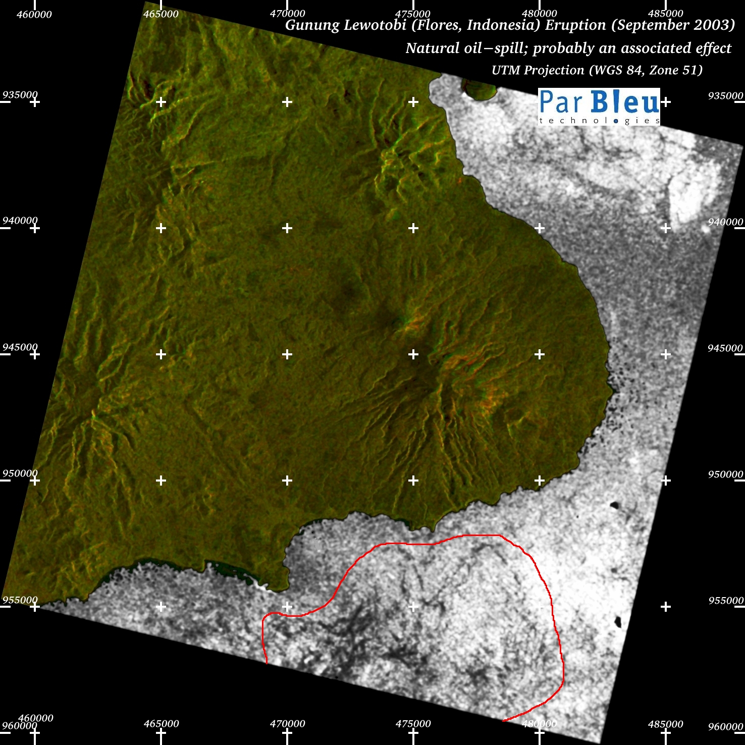
The map below (processing by ParBleu Technologies Inc.) is produced in cartographic projection UTM WGS 1984 (Zone 51),
at a spatial resolution of 20 meters x 20 meters.
UTM geographic coordinates are indicated on the map.
The Radarsat-1 radar imagery used to produce this map has been orthorectified (a digital terrain model has been produced for this purpose).
The size of the area shown is 30 x 30 kilometers.
 |
A natural oil-spill has been detected on the Radarsat-1 radar image acquired on September 18, 2003.
This oil spill is visible as a complex of black patterns within the red-marked area, off the southern shores of Flores Island, at a distance of 10 kilometers from the erupting volcano. It is likely that this oil spill was caused by the seismic events associated to the eruption of the Lewotobi laki-laki in the first two weeks of September 2003. |
|---|
Produced by PARBLEU TECHNOLOGIES Inc.
Procurement of the original RADARSAT-1 SAR data: Canadian Space Agency, and Radarsat International Inc.
Original RADARSAT-1 images: Copyright Canadian Space Agency / Agence Spatiale Canadienne, 2003.
Copyright (C) PARBLEU Technologies Inc., 2003