|
|
|
 |
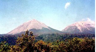
On September 1, 2003 at 7.30 pm Mount Lewotobi Laki-laki on Flores Island, Eastern Indonesia erupted. It was spewing ash, lava, rocks and other volcanic material in the form of fireballs. Minor and major eruptions were recorded during all the month of September 2003. Hundreds of hectares of crops on the mountainside such as rice, corn, coconuts and coffee were destroyed and forest fires have been sparked out of control around the volcano.
The places Boru, Boru Kedang, Nawa Kote, Nuri, Nobo Kanga and Hokeng Jaya are all located on the slopes of the volcano, home to more than 10,000 people. The most affected village was Hokeng Jaya with a population of around 2,300 people. The village was covered with volcanic ash measuring three-to five centimeter deep. |
|---|
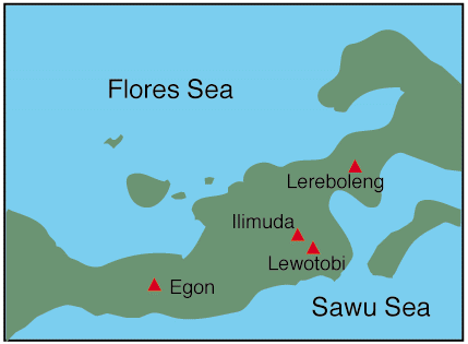
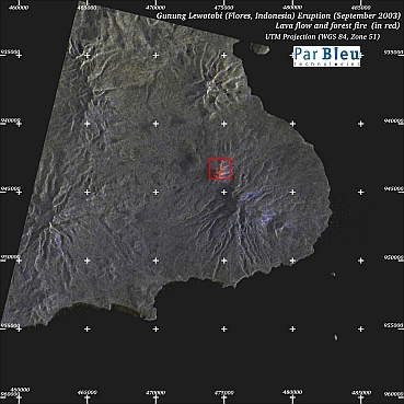
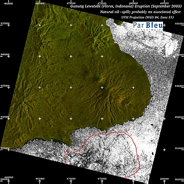
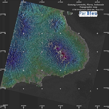
The area of interest (i.e. the area affected by the eruption) that has been surveyed extends over 30 x 30 kilometers.
All the detailed maps (processing by ParBleu Technologies Inc.) are produced in cartographic projection UTM WGS 1984 (Zone 51 L), and at a spatial resolution of 20 meters x 20 meters.
On all maps, crosses are spaced every 5 kilometers, at UTM coordinates that are a multiple of 5000.
Click on the image for a full resolution map
Click on the image for a full resolution map
Click on the image for the full resolution map
Produced by PARBLEU TECHNOLOGIES Inc. under mandate of the Canadian Space Agency.
(Standing Offer for Disaster Management Information Products and Services; PWGSC File Number 9F028-014927/A)
Procurement of the original RADARSAT-1 SAR data: Canadian Space Agency, and Radarsat International Inc.
Original RADARSAT-1 images: Copyright Canadian Space Agency / Agence Spatiale Canadienne, 2003.
Operational partners of PARBLEU TECHNOLOGIES Inc. :
 |
 |
 |
 |
| Privateers NV | Treemail | PT Ekokon Nusantara | AP Formation |
Copyright (C) PARBLEU Technologies Inc., 2003